This railroad became part of the Chicago, Milwaukee & St. Paul in 1872. The CM&StP (Milwaukee Road) had already constructed a line from Sabula, to Chicago.
By 1881, the Milwaukee Road continued to build west. A new line would be constructed through towns such as Toledo, Huxley, Madrid and Perry.
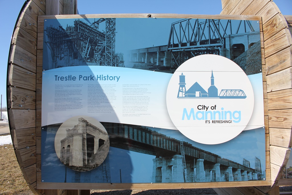
In 1882, the railroad continued to build west through more towns, such as Coon Rapids, Manning and Neola.
By the end of 1882, the railroad finally reached Council Bluffs.
Although the long mainline was completed, it had many issues. Bridges were not built to standard, curves were an issue; and specifically in the western part of Iowa, grades were atrocious.
Chief Engineer Charles Loweth began to address the problems in 1912. Fresh off of the Pacific Expansion, a veteran team helped redesign two mainlines: Minnesota and Iowa.
The expansion also added the "Pacific" to the title, creating the CMStP&P.
While the Minnesota line presented a fairly straightforward situation, the Iowa line presented more challenges.
The eastern portion of the state was simple, with slight grade and route changes. However, the western portion of the state required many route changes, grade reductions and large bridges.
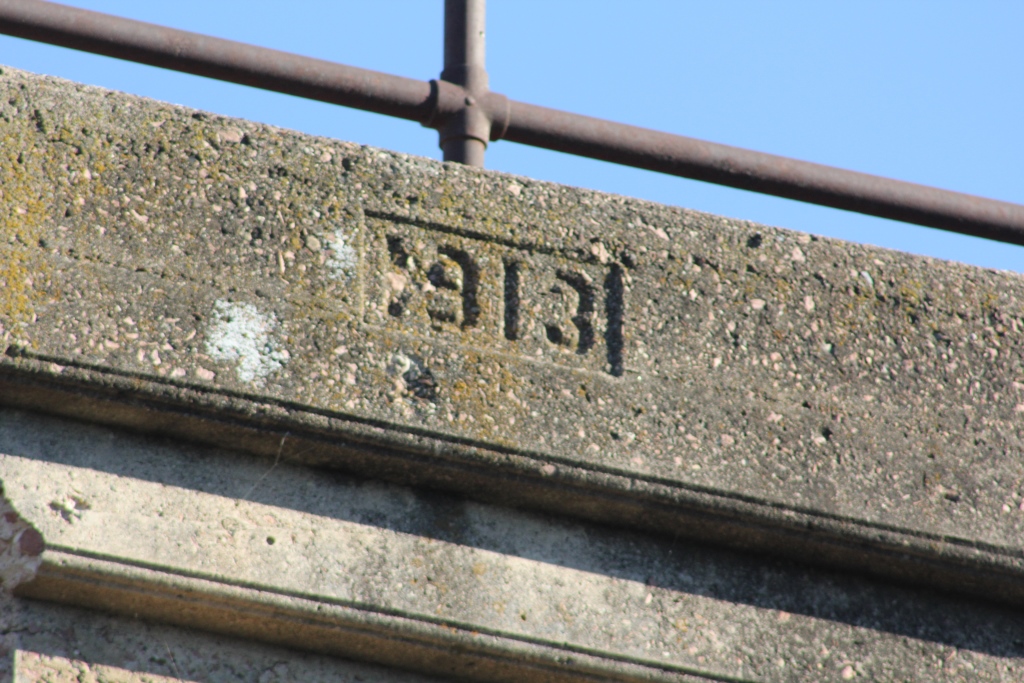
272 Miles would be completed by 1914, between Green Island, Iowa and Manilla, Iowa. This line featured sleek curves, reduced grades and a top class double track line.
In addition, the remaining track between Manilla and Council Bluffs would also be improved.
However, these expansions quickly were realized as too ambitious. Significant portions of the double track were pulled up. Sections included:
Templeton to Herndon and Newhall to Collins were reduced to single track in 1934. Paralta to Green Island was reduced in 1950, and Madrid to Collins in 1956.
Despite a fairly solid traffic base, the Milwaukee Road was oftentimes in trouble financially. At this point, a mass abandonment was court ordered for the Milwaukee Road. 791 miles in Iowa would be abandoned, including the entire Council Bluffs line.
However, some sections were kept intact. Burlington Northern purchased the line from Council Bluffs to Bayard. This is now the BNSF Bayard Subdivision. BNSF was formed from a merger of the Atchison, Topeka & Santa Fe and Burlington Northern in 1996.
In addition, Chicago & North Western was sold the line from Woodward to Slater, and from Herndon to Perry.
C&NW became part of Union Pacific in 1995. In 2003, the Woodward section was abandoned. In 2004, the Perry to Dawson section was abandoned. The Herndon section was abandoned in 1999.
In addition to the Bayard Subdivision, the Raccoon River Valley Trail and High Trestle Trail also utilize portions of this line.
08/24/21
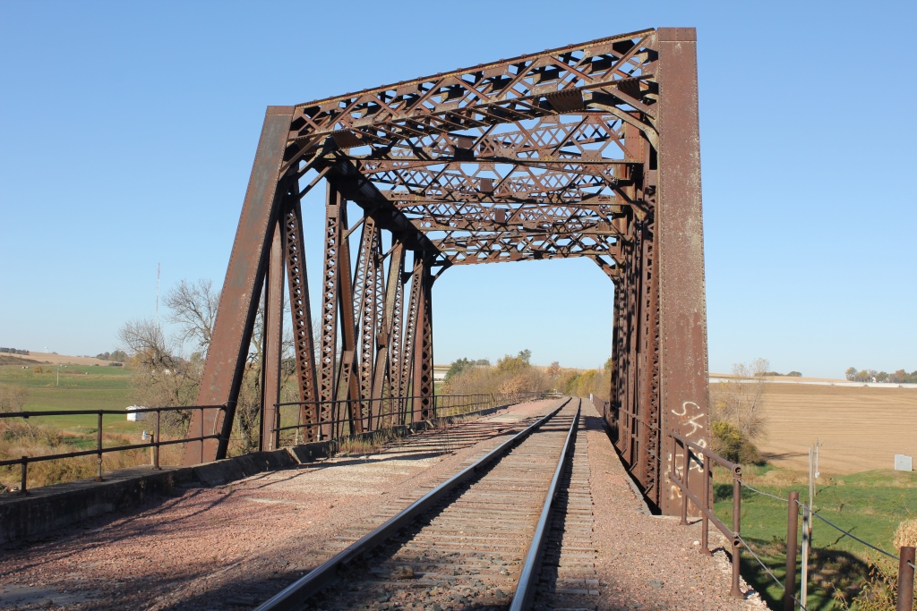
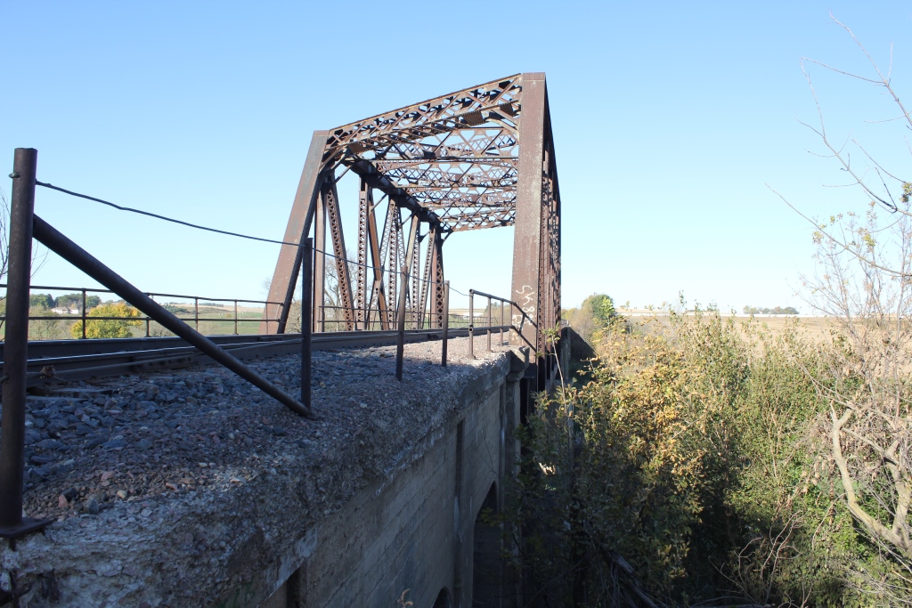
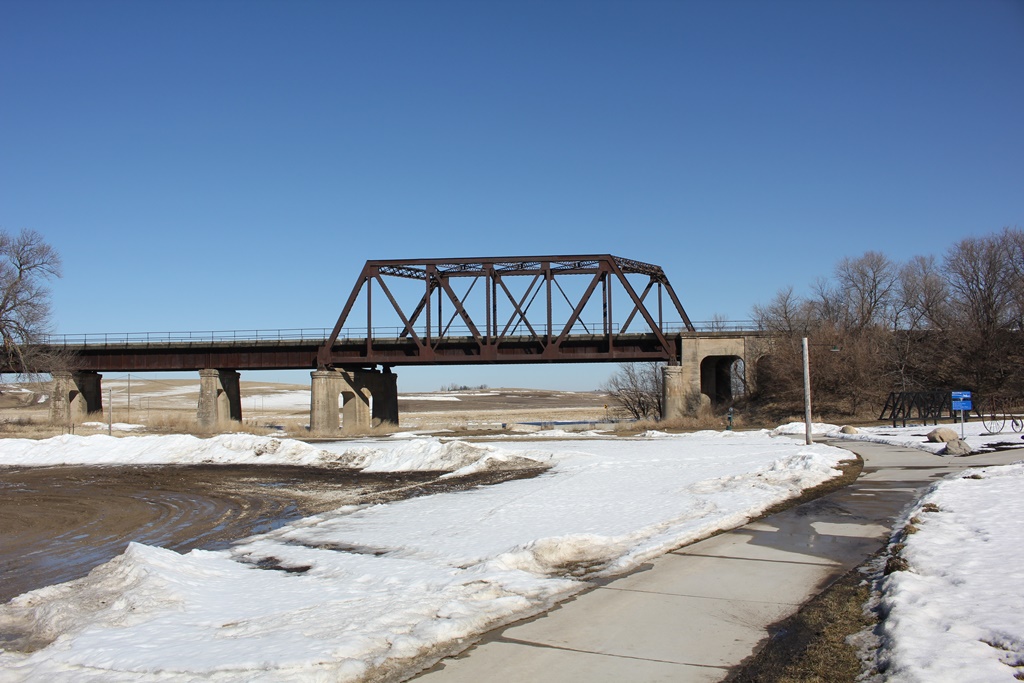
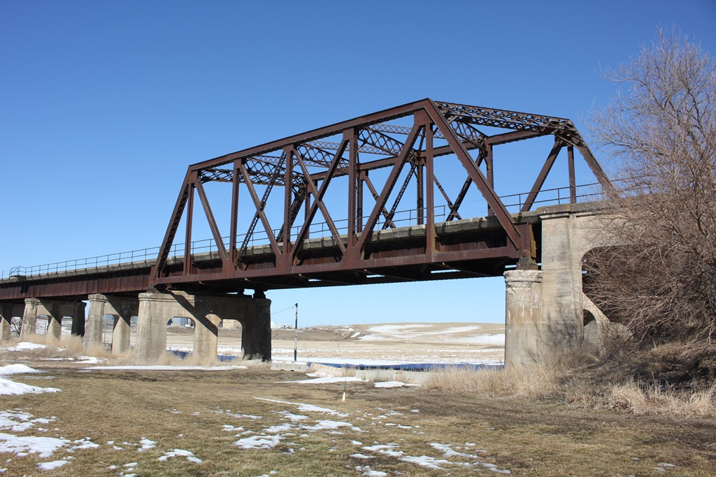
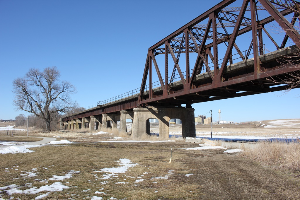
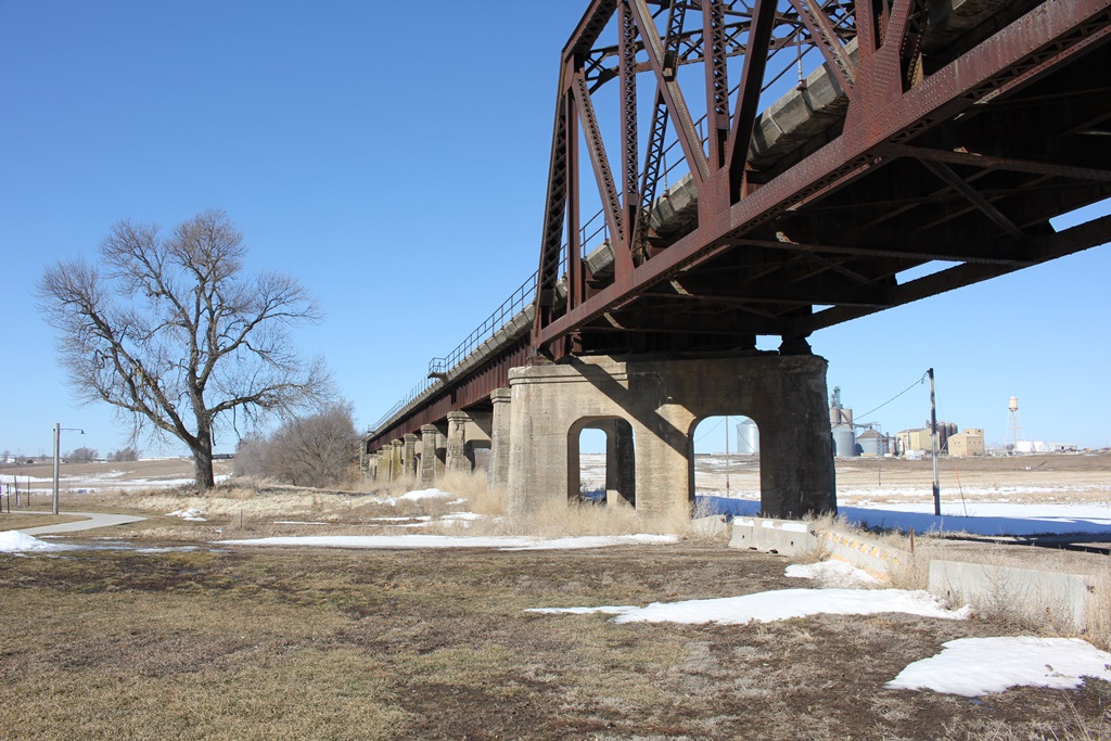
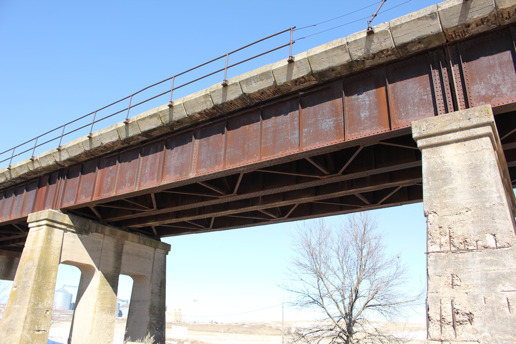
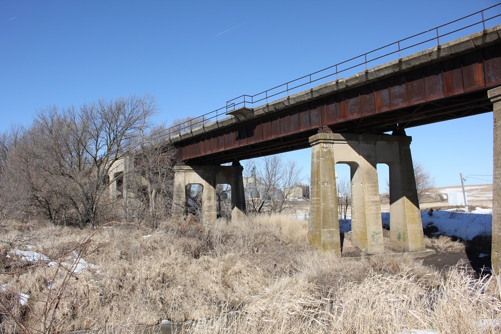
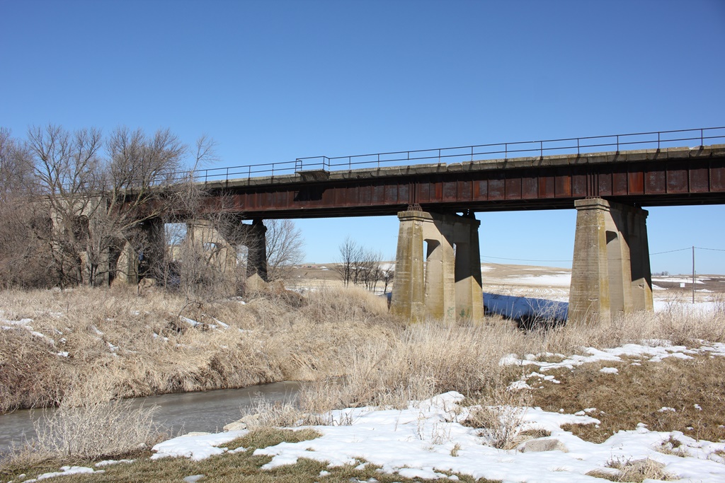
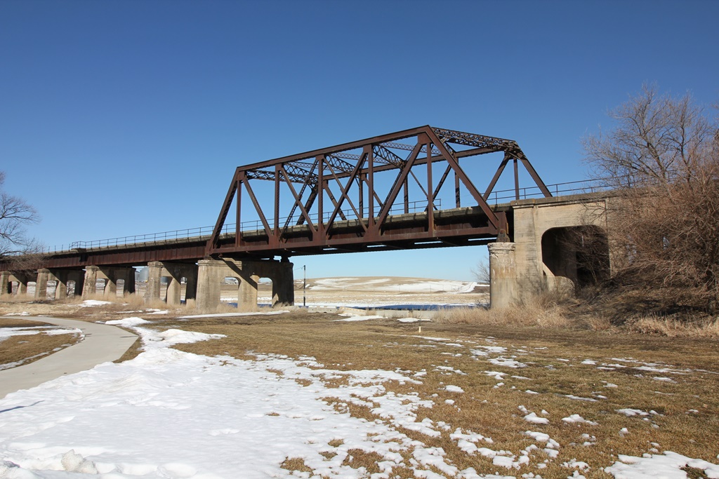
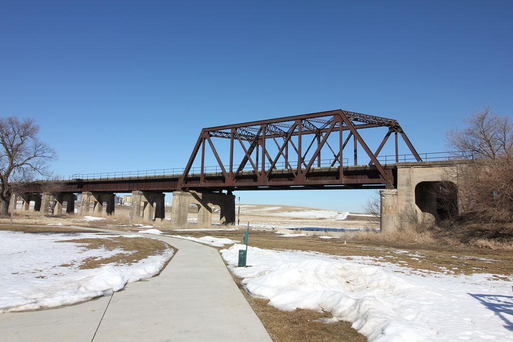
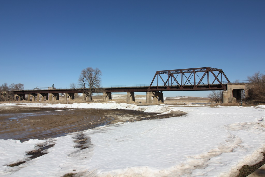
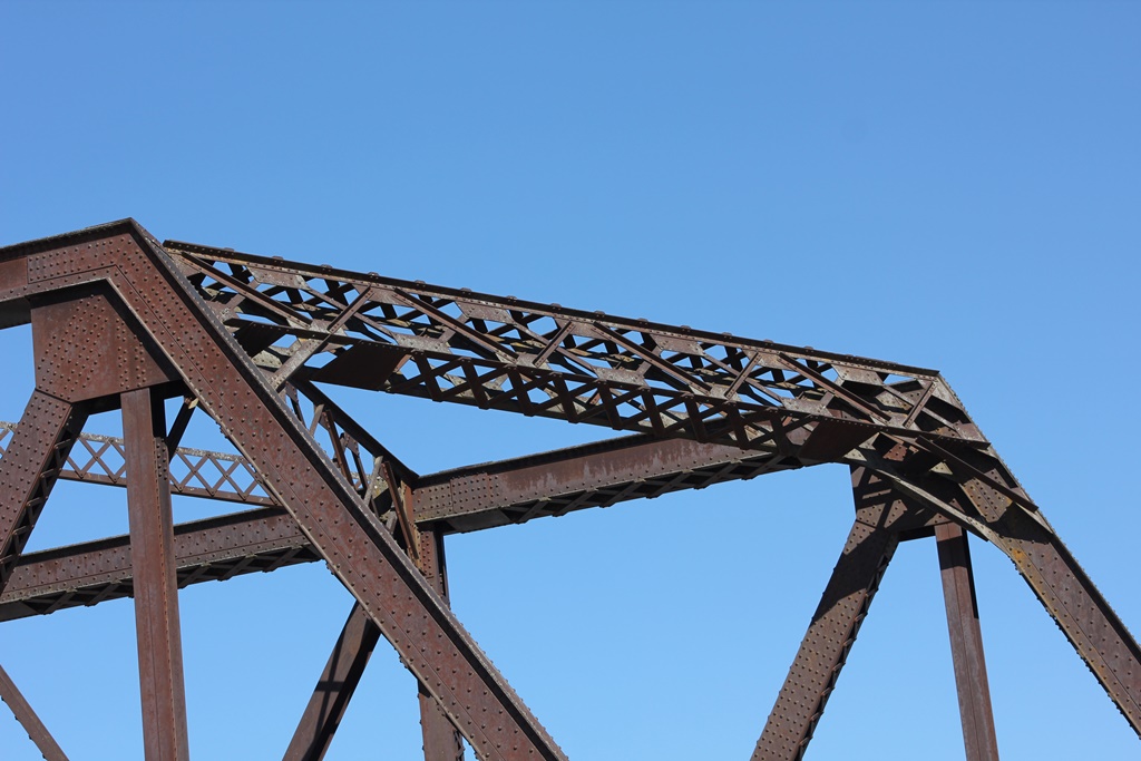
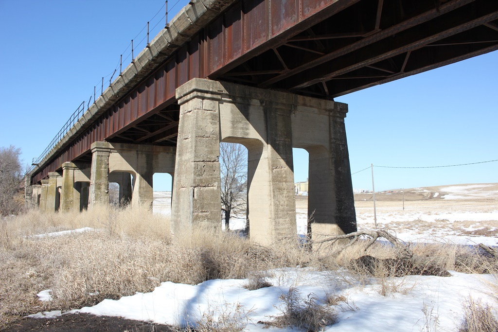
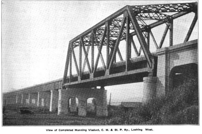
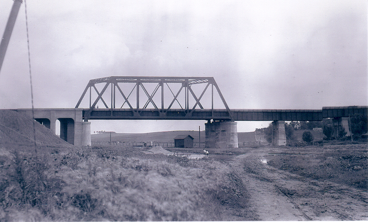
Located in the northwest corner of Manning, this truss is one of the most distinctive railroad structures in the entire state of Iowa.
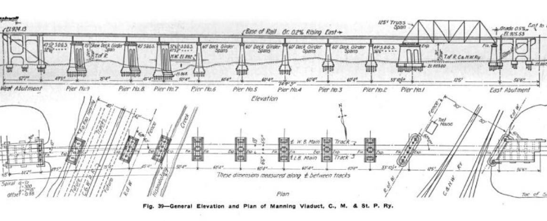
When the railroad relocated through town, a new bridge was going to be required to cross tracks of the Chicago & North Western, Chicago Great Western and the West Nishnabotna River.
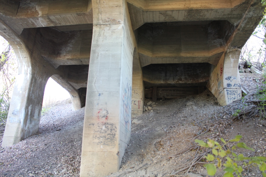
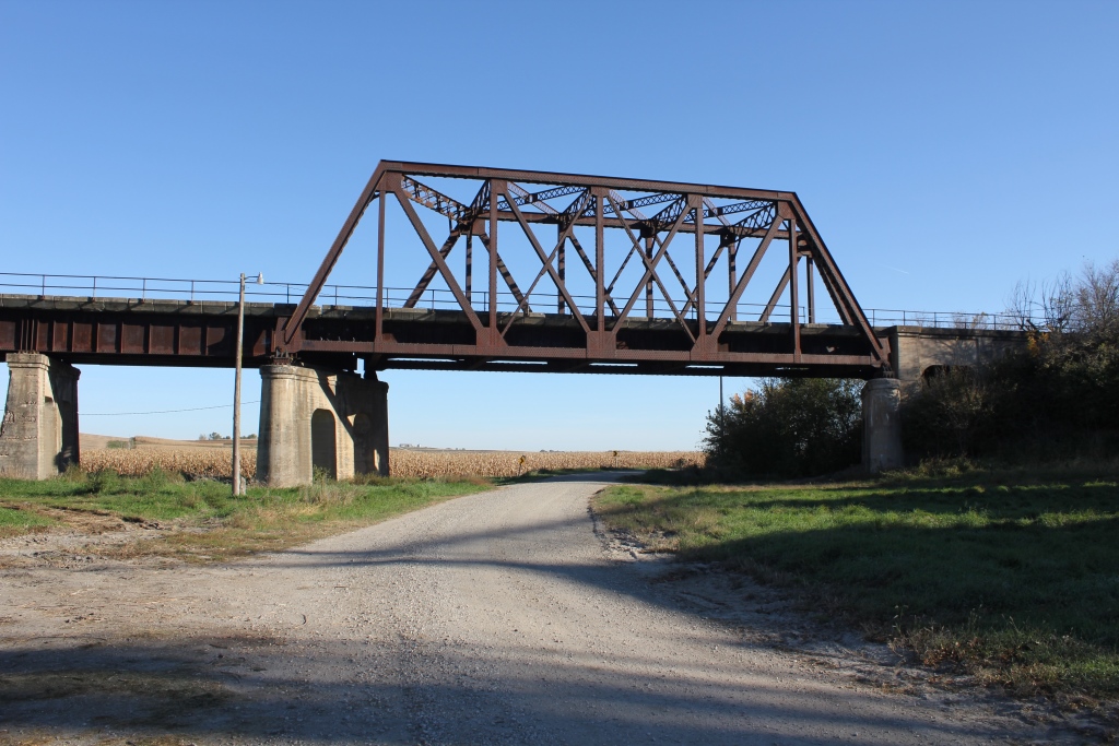
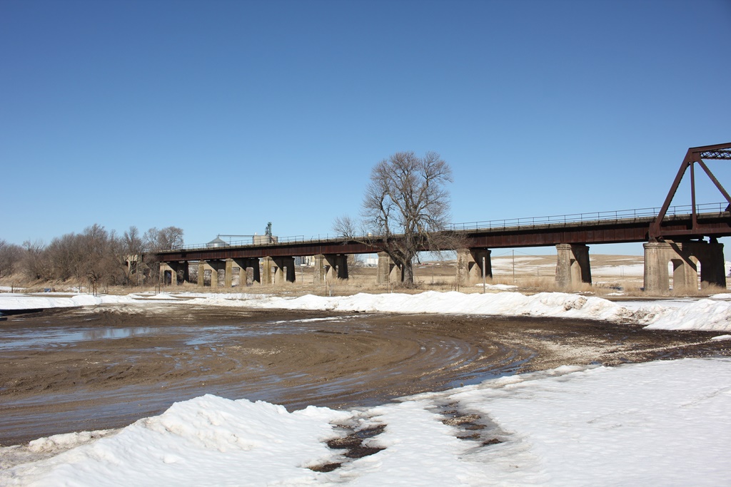
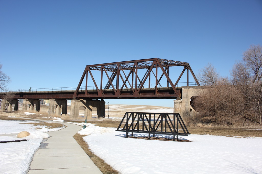
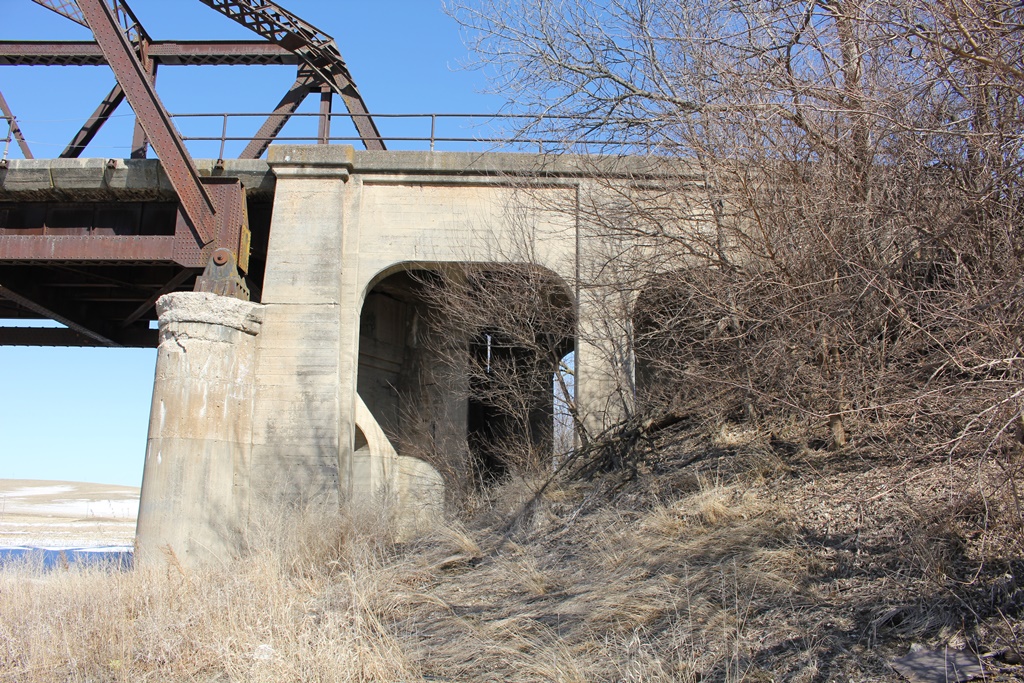
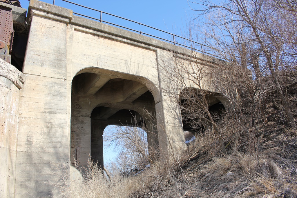
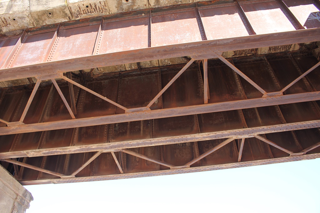
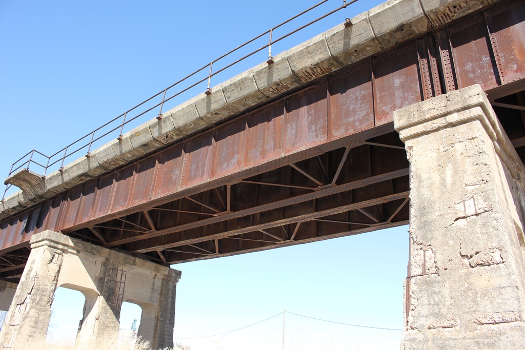
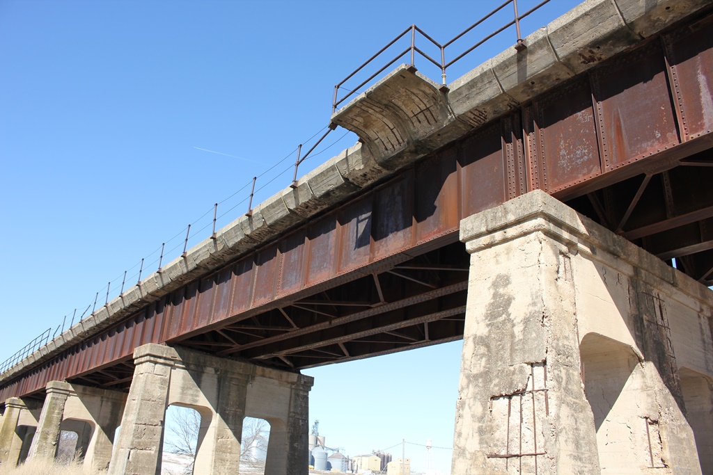
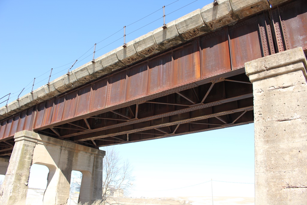
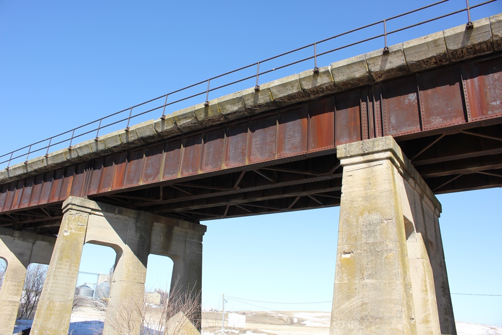
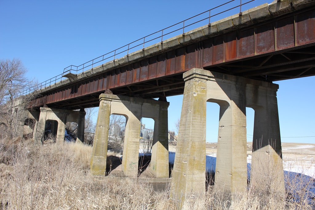
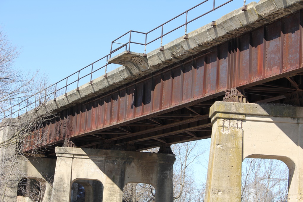
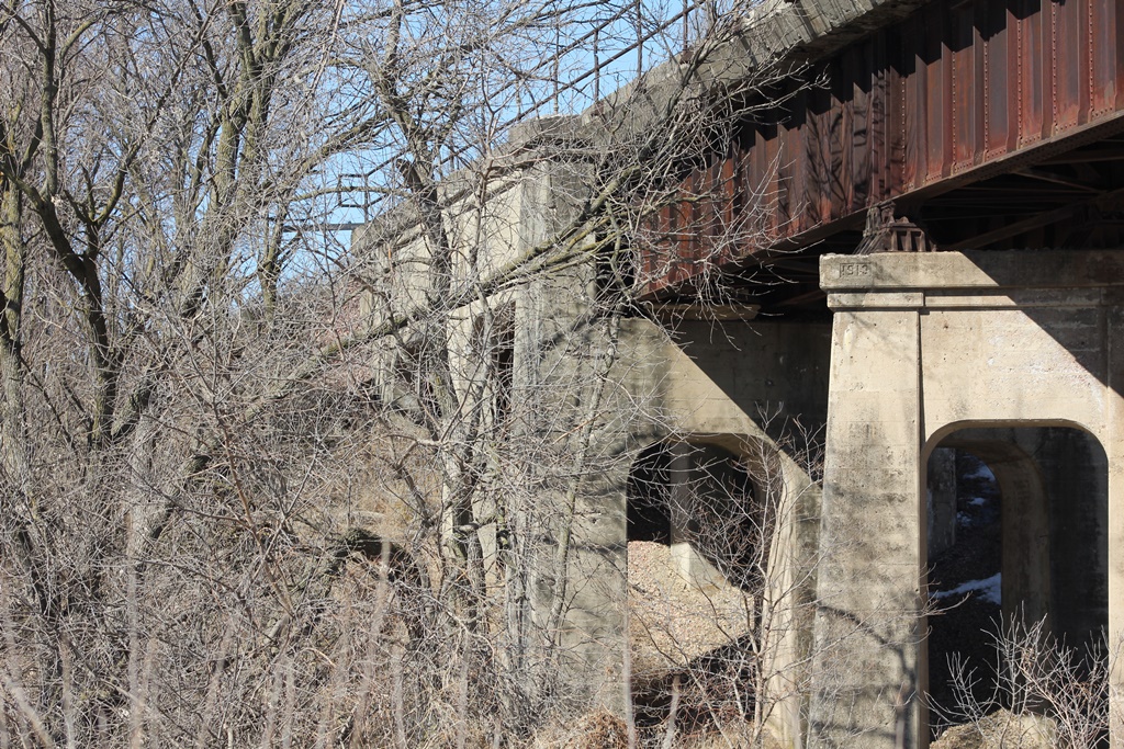
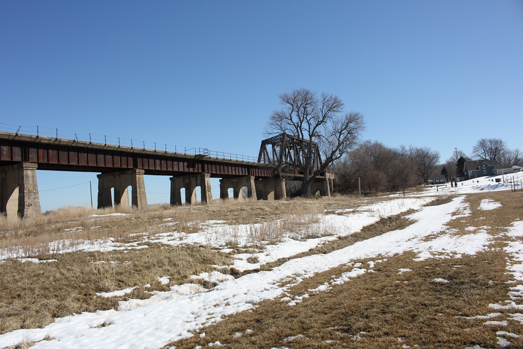
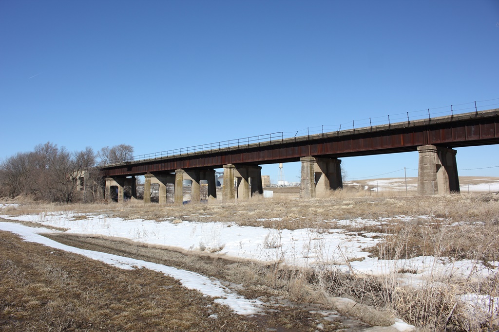
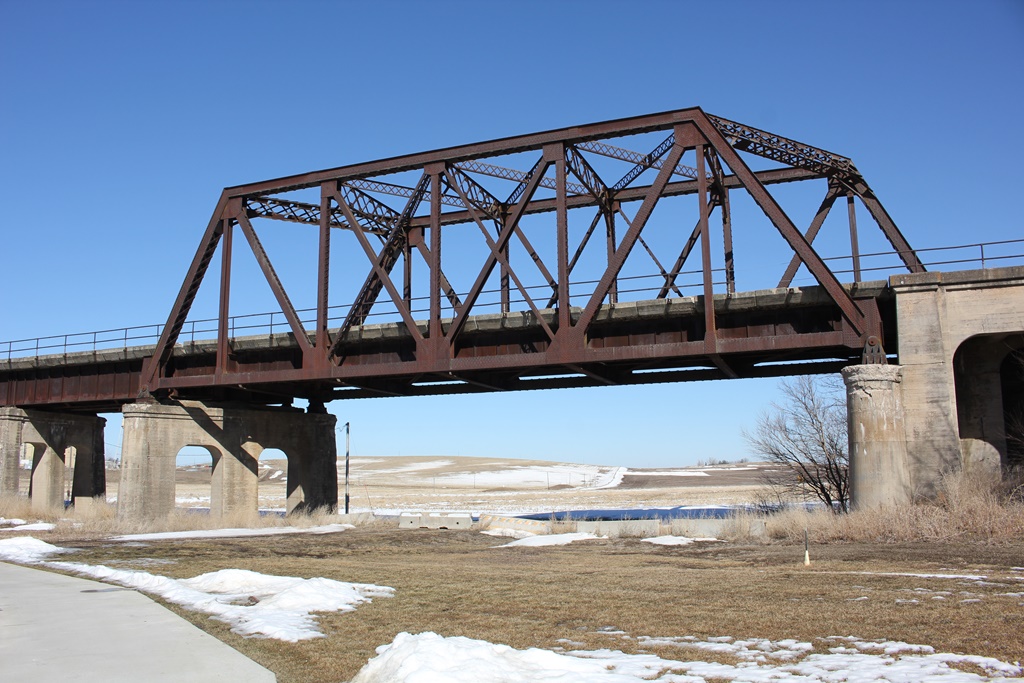
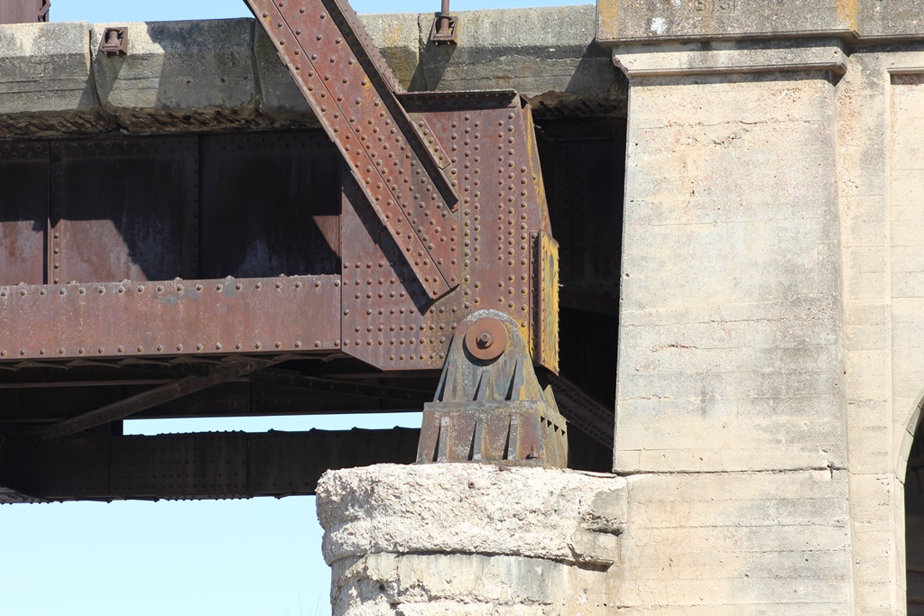
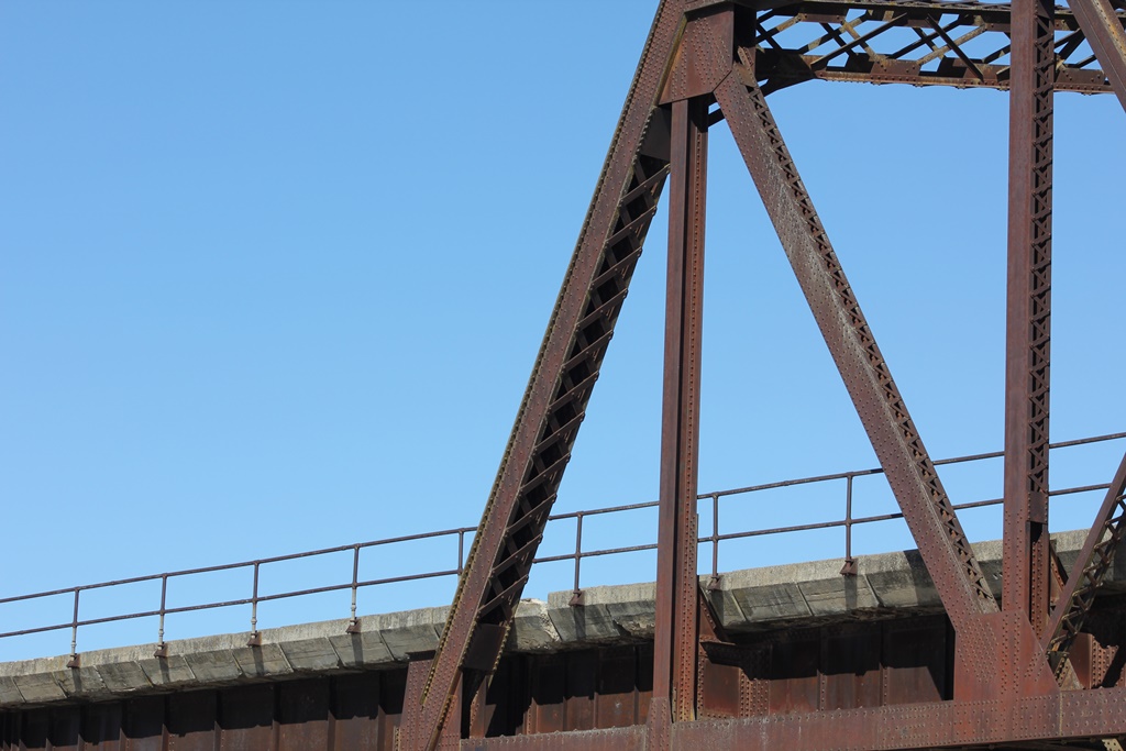
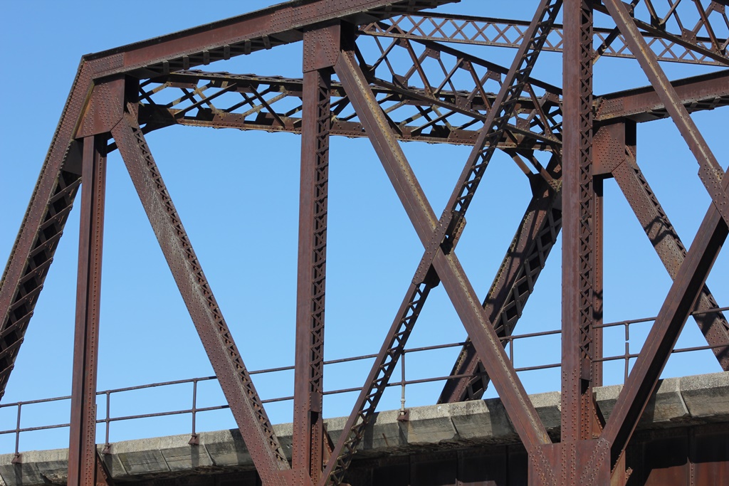
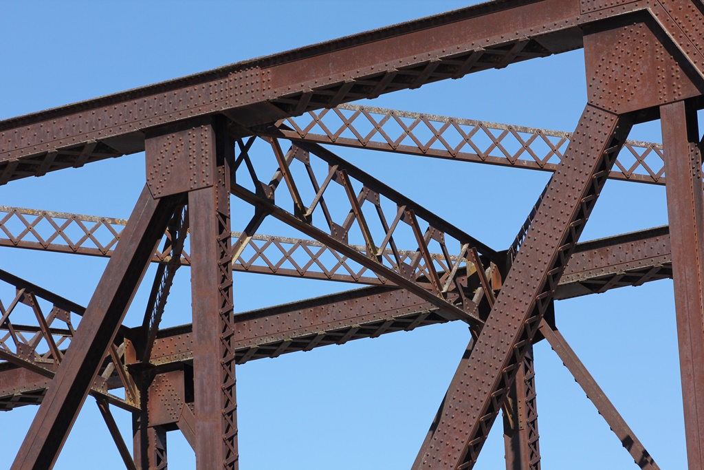
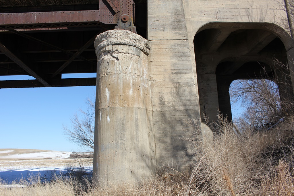
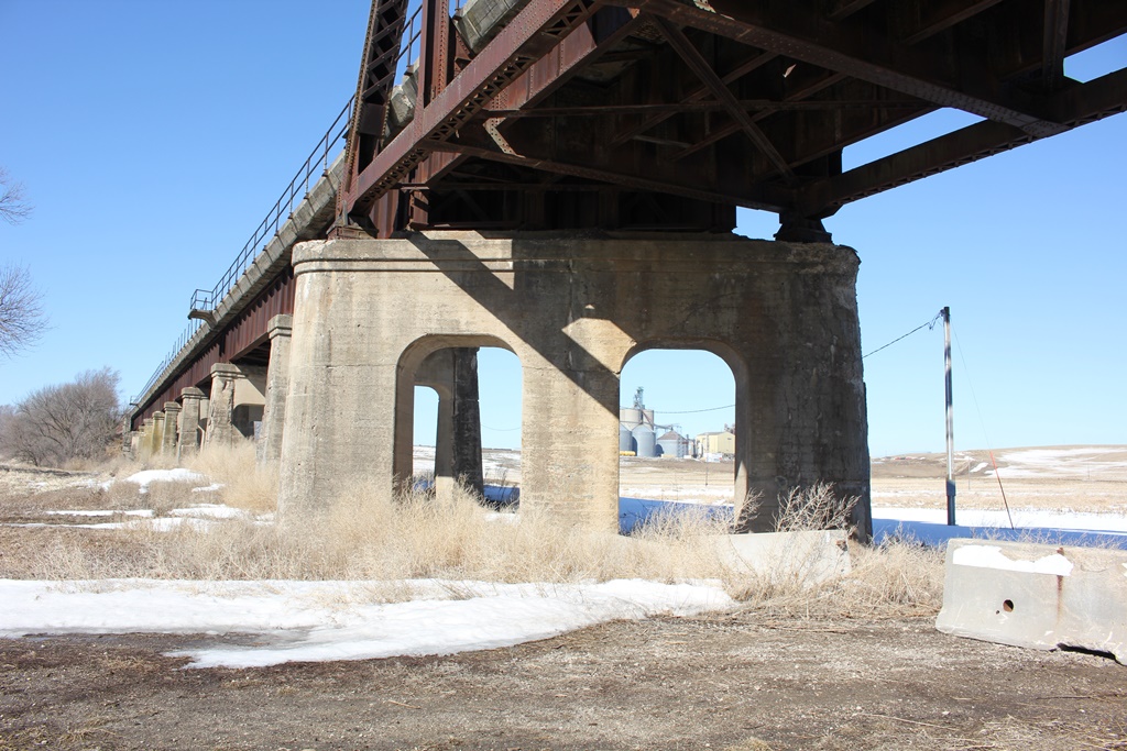
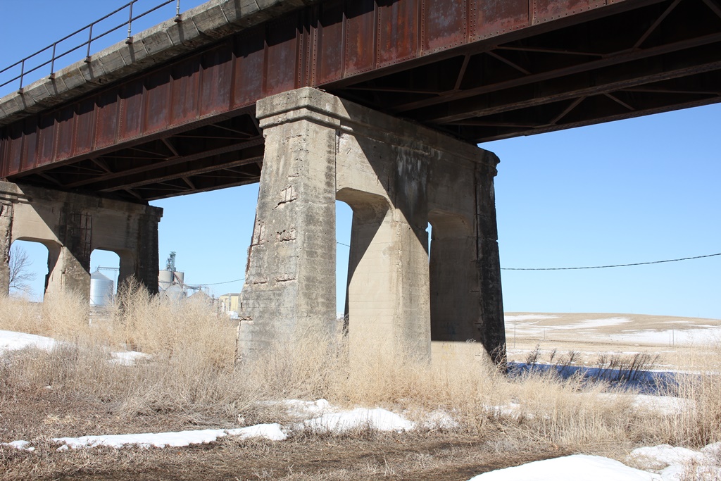
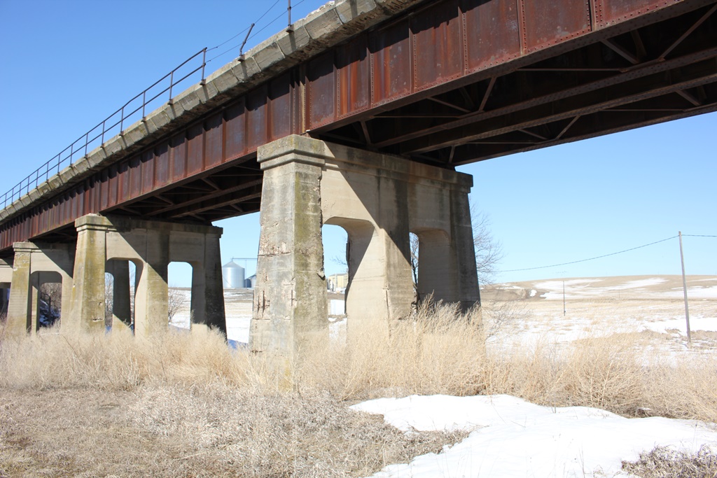
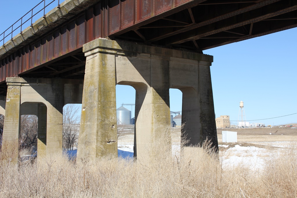
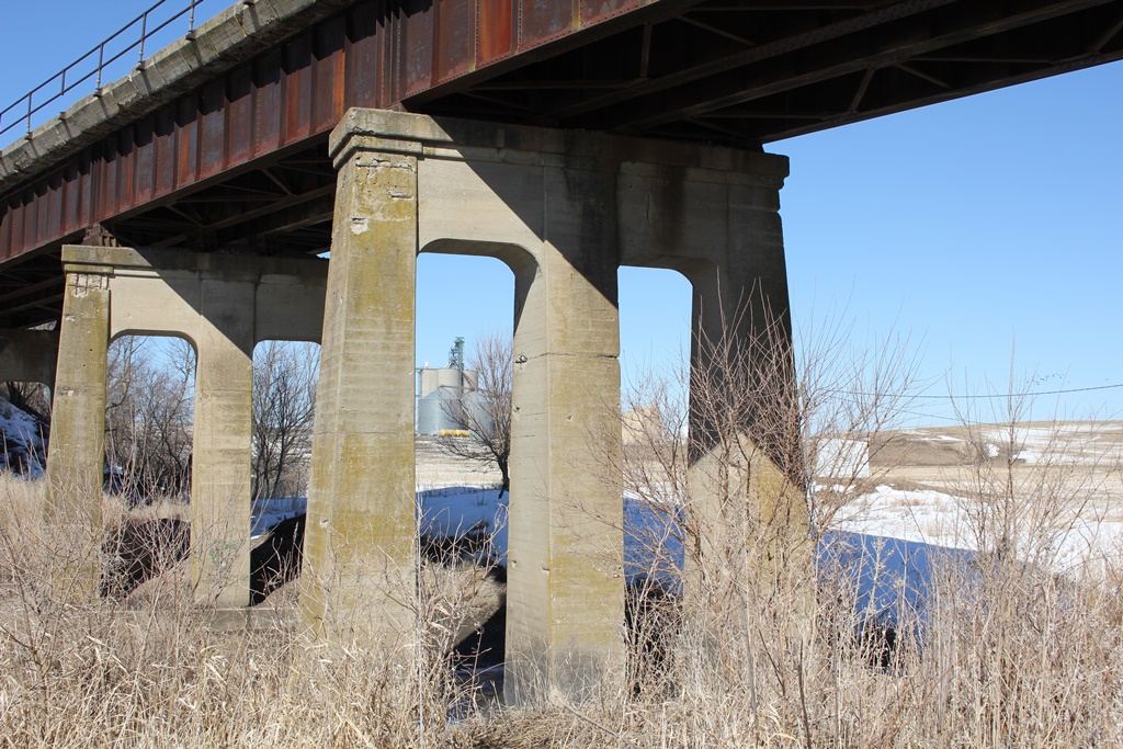
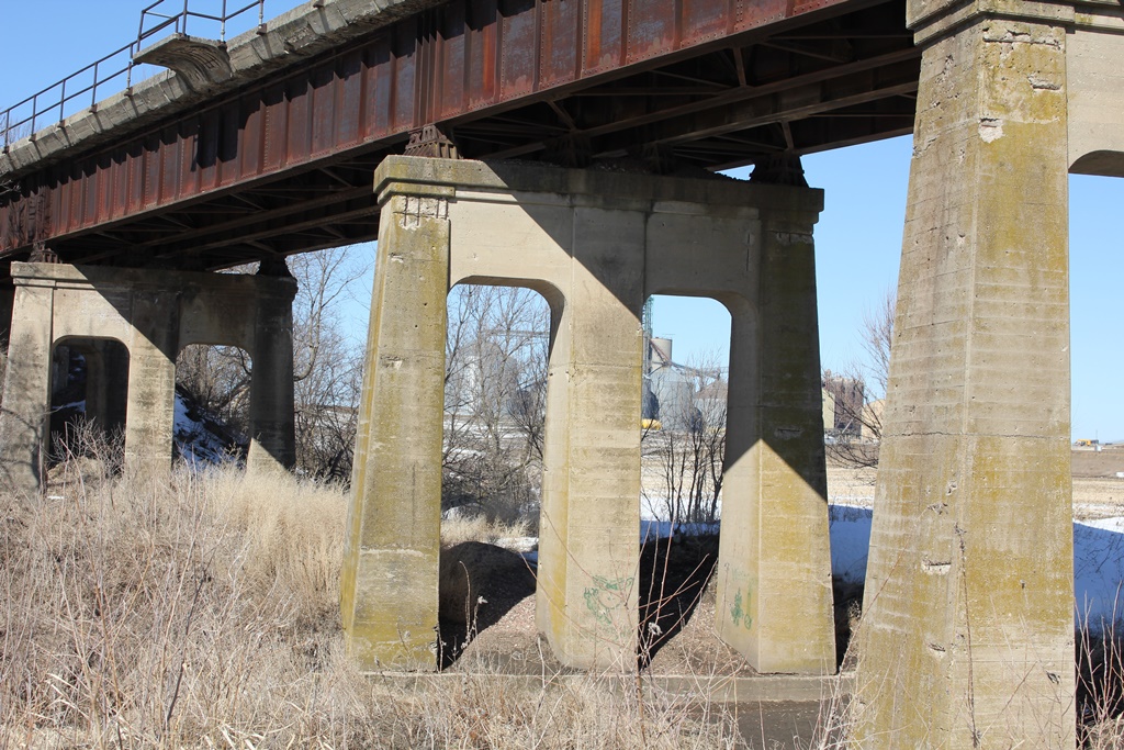
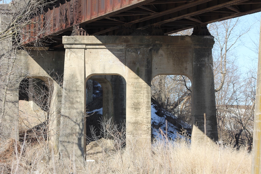
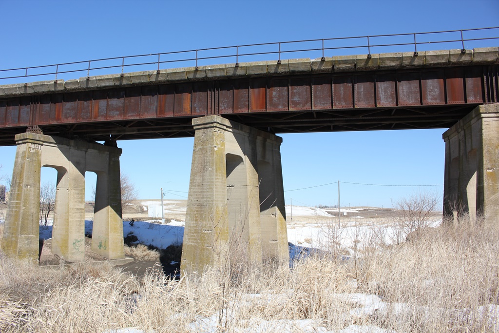
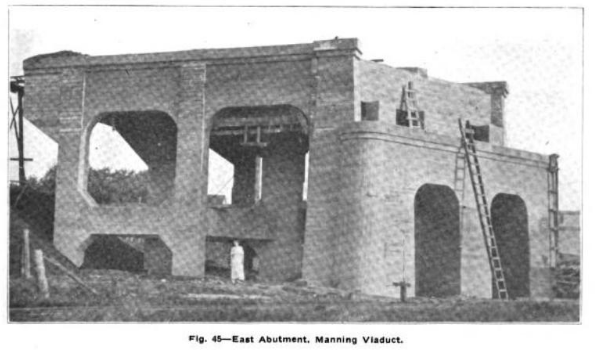
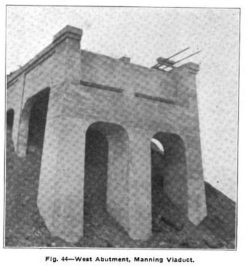
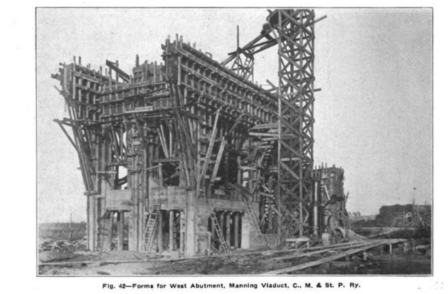
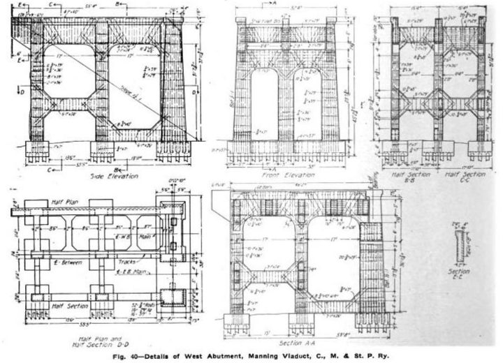
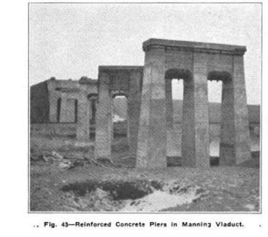
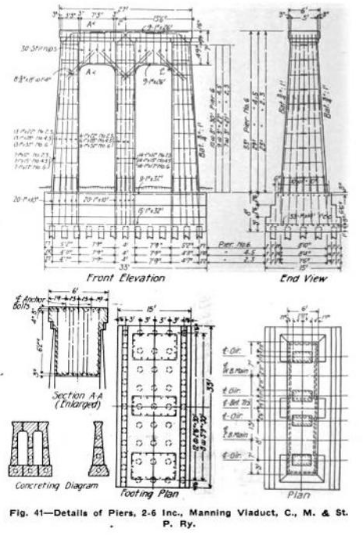
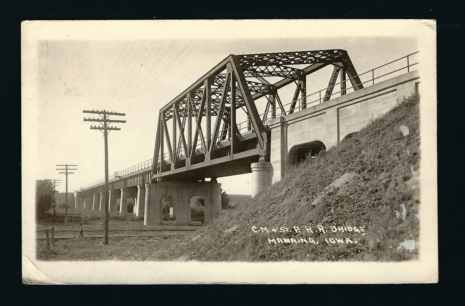
The solution was to built a massive bridge to cross all three barriers at the same time. The resulting bridge is the structure visible today, consisting of a truss and girder spans, set on the distinctive concrete arch substructures.
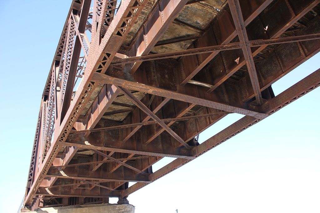
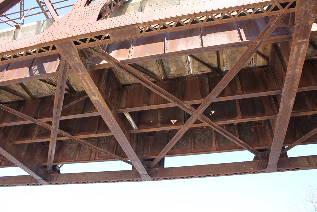
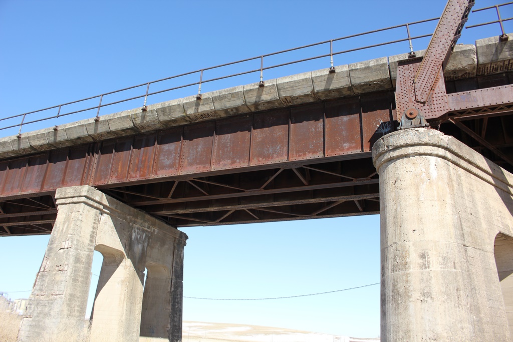
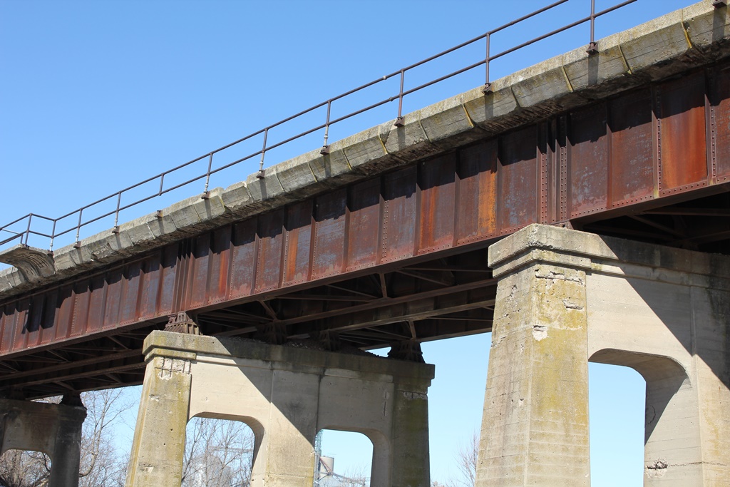
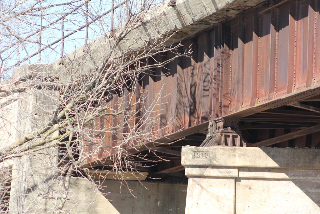
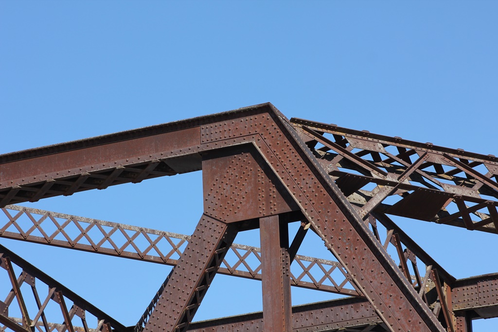
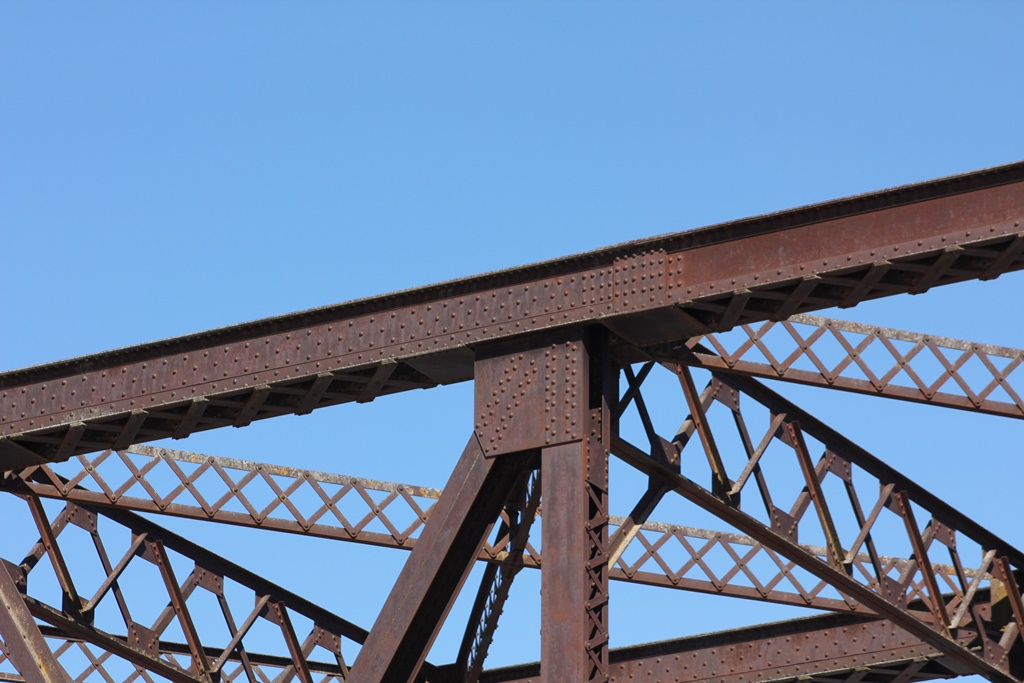
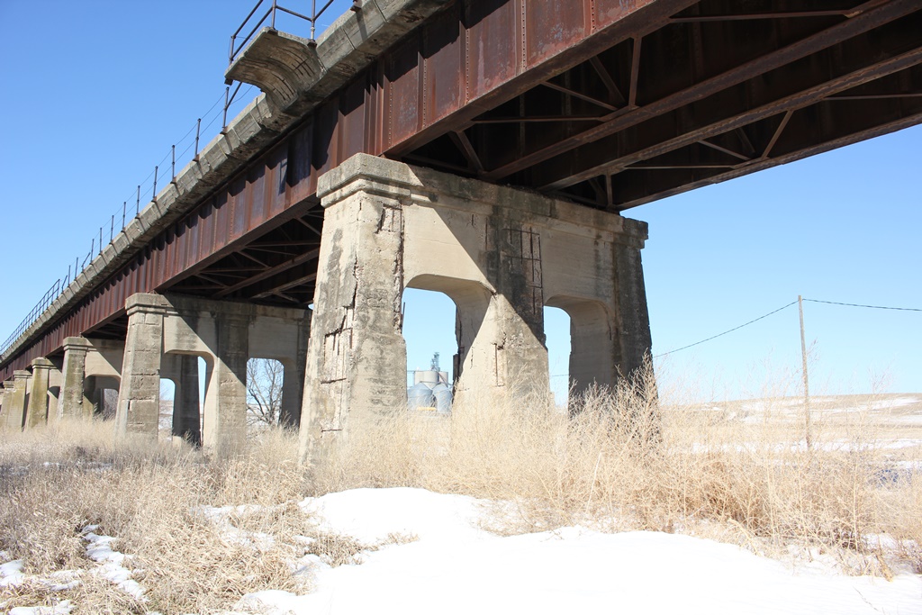
On the west end, a 52-foot concrete arch abutment approached the bridge, with nine deck plate girders, four at 60 feet long, one at 75 feet long and the other four varying in length from 45 feet to 52 feet. These spans crossed the Chicago Great Western Railway, the West Nishnabotna River and some open land. The main span of the bridge is a massive 6-panel, riveted Pratt Through Truss, which runs at a considerable skew. That span is approached by two more concrete arch approaches, 56 feet in length.
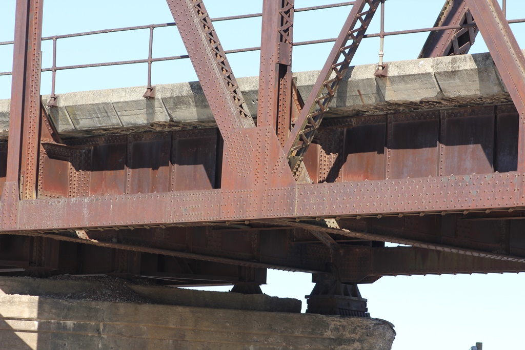
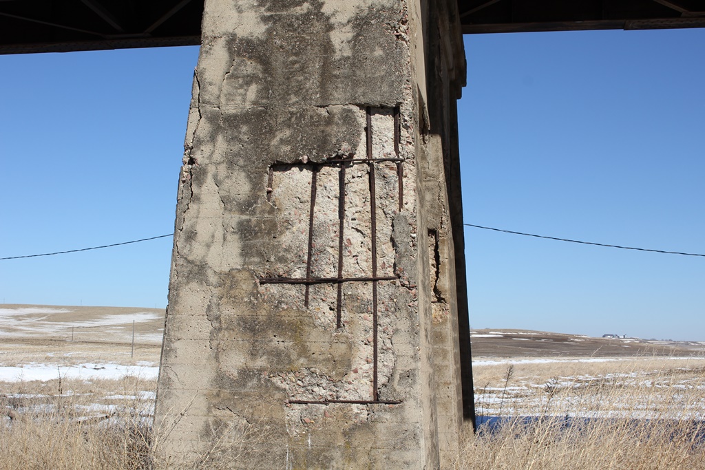
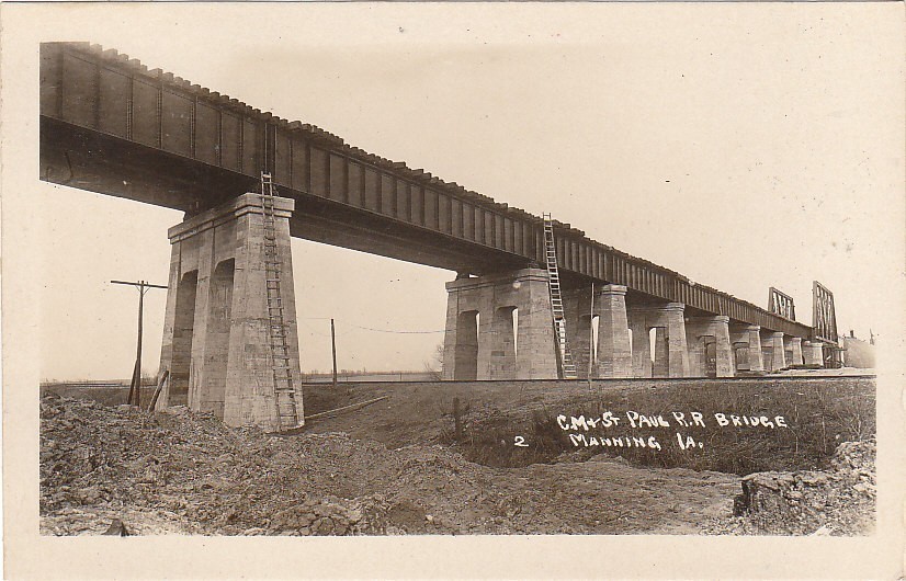
The piers of the bridge were constructed of concrete arch shapes, typical for the Milwaukee Road at that time. The bridge also featured a ballasted deck, with 13 inch concrete panels set on top of the bridge. Furthermore, the bridge features skew on the truss spans, and three deck plate girder spans on the west end of the bridge. A slight curve is also found on the west end of the bridge.
Today, the bridge itself is virtually unchanged, and in excellent condition, especially compared to other structures along this route.

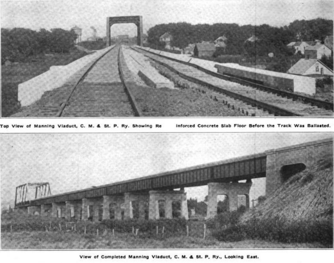
Bridge plans from Railway Review: Volume 54 (digitalized by Google)
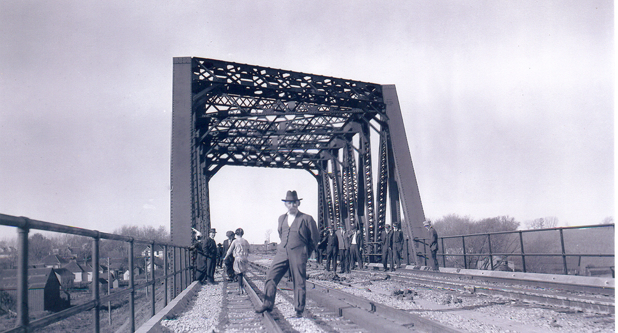
The truss span is very heavily constructed, with a heavily constructed portal, built up members and riveted connections. The bridge also still features many of the original components, such as the ballasted deck, the pipe railings and the trainman walks.
Unfortunately, the concrete deck panels are beginning to spall and expose the rebar, which eventually may cause the superstructure of the bridge to corrode. The ballasted deck was added to this bridge to help with maintenance, as well as prevent deterioration of the steel components, which is typical to open deck spans.
The concrete arch abutments were common along the Milwaukee Road lines that were rebuilt. They were used to help with erosion and slope control on the ends of the bridge, and create a more natural slope.
The old bridge was built of several deck girder spans, on lightweight steel towers. Some piers of the old bridge were visible just north of Iowa Highway 141 until the 1960s.
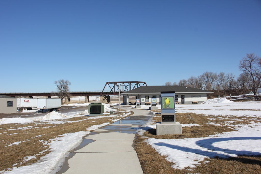
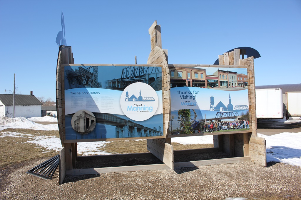
Overall, the bridge appears to be in good to excellent condition, with no serious corrosion or spalling noted. Manning has decided to build a park along the southeast corner of the bridge, which grearly improves accessability to the structure.
The author has ranked the bridge as being regionally significant, due to the large size, unique design and iconic status of the bridge.
The photo above is an overview. As part of the documentation of this bridge, the author has numbered the piers and spans from east to west, such as in the original plans for this bridge.